


13146484-Buberté 19.01

togolo28
User
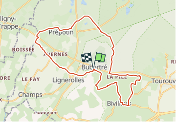

Length
19 km

Max alt
318 m

Uphill gradient
331 m
Km-Effort
23 km

Min alt
209 m

Downhill gradient
333 m
Boucle
Yes
Creation date :
2021-05-29 18:24:56.609
Updated on :
2023-03-19 16:36:43.946
--
Difficulty : Medium

FREE GPS app for hiking
 SityTrail
IGN / Geographical institutes
SityTrail Plus
The world is yours!
About
Trail Walking of 19 km to be discovered at Normandy, Orne, Tourouvre au Perche. This trail is proposed by togolo28.
Positioning
Country:
France
Region :
Normandy
Department/Province :
Orne
Municipality :
Tourouvre au Perche
Location:
Bubertré
Start:(Dec)
Start:(UTM)
323040 ; 5385312 (31U) N.
Comments